Today I went on my last long ride before IMC. My friend Tom and I had a great urban training ride following Puget Sound from downtown Seattle south. And this after a loop around Mercer Island. As we headed out to Alki we could look across Elliot Bay to downtown Seattle with the tall buildings rising up out of the fog.
Rounding the northern end of Alki we rode into a dense fog bank where we were serenaded by the ferries' fog horns. In a few miles we rode out of the fog at Lincoln Park then up into the sunshine (but still cool air) as we climbed the hill from the Fauntleroy Ferry.
We continued south for the breath-taking descent to Three Tree Point quickly followed by a climb back up Sylvester Road and another twisting descent to Normandy Park where we hooked back up to Marine View Drive.
Then Des Moines and White Center, more hill climbing, and another, final descent to the Kent Valley and the Green River. After a brief detour due to road construction we were on our way to Renton and finally the bike path north along the eastern side of Lake Washington.
Truly a great day for this final run-up to IMC. An easy weekend ahead to start taper time.
Friday, August 13, 2010
RAMROD, 2010 Version
The 2010 RAMROD is in the bag.
My friend Gary and I rode together on this one. He was really hanging it out there as his longest training ride had been 70 miles and that was a while ago. But he's also tough and smart enough to ride within his limits.
When we got to Enumclaw at 5:00 am there was a heavy fog, so heavy that it was almost like a misty rain. When we took our bikes off the rack they were coated with condensation. Lucky that I had a towel in the trunk to dry off the seats. It would have been pretty unpleasant to mount up on a wet saddle.
The first 60 miles or so are gentle hills or flat to the Longmire entrance of Mt. Rainier National Park. At about mile 35 there was a water/fuel/potty stop which we took advantage of. Plus, I saw my old friend Marilyn Williams. Since she's close to my age I had to compare ride numbers with her: 45 (her) versue 41 (me). This is a game one can play all day long because the numbers are issued in reverse age order. I.e., the oldest rider is #1 and the youngest rider is the highest number. With 800+ riders a number in the 40's puts you into the seriously old codger cadre.
Gary and I hung together well to the second rest stop. We had a pretty short stop there, just long enough for us to get some fluids and food and for me to use the toilet (an ongoing theme for the day). Just as we were getting to this rest stop the fog burned off. Now we had sunshine. Then on to the park.
They were ready for us at the entrance with a special lane just for the RAMROD riders. Then it was several miles of gently rising road through old growth forest and paralleling a glacial river.
At Longmire we started up the first climb of the day. About 8.5 miles of steady up to the Reflections Lake rest stop where we spent about 30 minutes. A teensy bit more climbing and we were at Reflection Lakes with Mt. Rainier looming above everything to the left and the Tatoosh Range to our right.
Down, down, down, down: much descending to the Box Canyon aid station where we had chocolate croissants and no mosquitoes. This descent had some rough road, lots of drainage grates, and 2 tunnels. The last bit of Box Canyon followed this aid station then the short climb over Backbone Ridge.
More descending, this time with some pretty beat up road. The RAMROD folks were kind enough to mark the worst spots with fluorescent green paint. This was great because we were into and out of sun so that sometimes it was hard to see the rough spots until you were right on them. At 30+ MPH this is a bit un-nerving!
After this descent we exited at the Ohanacoposh entrance and turned left for the biggest climb of the day: Cayuse Pass. In total there's about 15 miles of climbing. The first part is gently rising through the forest. Then you go through a tunnel. It's long and uphill and VERY disorienting. The forest shade is pretty much gone from this point to the 4000+ summit of Cayuse Pass. Today was not beastly hot; this can be a real furnace some years.
After a quick toilet break we had the delicious descent to the lunch stop. About 8 miles of good road and gentle curves, open and sunny at first and eventually diving into the forest. A quick turkey and swiss sandwich plus drinks, fruit, and other goodies and we were on our way to the last section.
I've never liked this part. It's about 35 miles back to Enumclaw, slightly downhill but always with a headwind. It's just a slog. A few miles in we managed to hook up with 3 other riders in a pace line where we pulled each other along at 23 MPH or so. It was good to sit in the slipstream much of the time.
After Gary got on the front and did his pull the other 3 decided to pull off because their heartrate was too high! Gary and I continued on together through the last of the downhill and the long hill up to the Mud Mountain Dam turn. It was much more pleasant once we got off the highway as the traffic dropped off to nothing.
After the thrilling Mud Mountain descent back to the Enumclaw Valley we were back to farms and rectilinear roads. One turn and a straight shot of a couple miles and we were back to the ice cream truck.
We were very pleased with our day: less than 12 hours on the road, 10 hours riding time, 150 miles, 10,000 feet or so of climbing. And Gary was strong.
Ross Family Reunion, 2010
(This posting is courtesy of my sister).
As the 2010 Ross Reunion drew near, we all prepared for our journey from near and far -- New Mexico, Arizona, California, Florida, Montana and Washington. We came by plane, automobile and motorcycle. Each of our journeys a little different than the others, but with one goal in mind, to meet up with the members of the Ross Family for a weekend of sharing, catching up and playing together, not to mention all the eating.
It was wonderful to see the little ones at the reunion. The great great grandchildren, great grandchildren and grandchildren of Ray and Lena Ross. Family and friends gathered together to celebrate family.
Beanbag Battle was the hit among the adults and older children. Competition is alive and well in the Ross Family. The only way the game was finally called was because it started to rain, and no one wanted the game to get wet and swell up, which would have meant no more Beanbag Battle.
What a joy to see the little ones pulling the wagons around, running through the sprinkler and swinging on the rope swing in the willow tree. At the end of the day they were exhausted, with one little one falling asleep in his Grandmother’s arms, and laying down on a blanket on the ground fast asleep.
It was a delight to see the Ross siblings loving on each other, telling tales and catching up on what they had been up to the past few years. Eight of the fourteen children were here. Fourteen children is just amazing -- 10 girls that resemble their mother and 4 boys that resemble their father -- kids that started out in a coal mine town in Montana. Each started their own lives spread out over several states, still caring for each other, coming together to celebrate family and each other.
There was abundance everywhere -- the love, the caring, the fun, the food, especially pies and cakes.
Happy Trails to each of you, may we all meet again.
Sunday, July 11, 2010
Death Ride, 2010
Another Death Ride in the bag. For those of you unfamiliar with it, this ride occurs in the California Sierra Mountains just south of Lake Tahoe. Not huge mileage (130) but lotsa climbing (15,000 ft).
Janet and I arrived at Lake Tahoe (a gem of another story) a week early to enjoy the heat and the hikes in the mountains. There are 3 wilderness areas all in close proximity to the south shore of Lake Tahoe. I'd recommend this to anyone who likes hiking.
The Wednesday before the ride I took a tuneup ride from our motel to Luther Pass, just to see if everything was working well after a plane trip. It was.
Friday night arrived and I packed everything into the car. We had rented this monster Mercury so that we could easily transport a bike. Problem was that I couldn't fit the bike into the trunk with the back wheel on and was afraid of getting grease on the rent-a-car upholstery by putting the bike into the back seat so I had to remove both wheels. I just hate to start out a ride with greasy hands but it couldn't be avoided.
I allowed an hour to drive from South Lake Tahoe to the ride start in Markleeville, planning to be there at about 5:30 a.m. I left on schedule and actually got there a little early. Since there are 2500 riders and this is a teeny little place, folks park their cars all along the road that goes through Markleeville. I ended up 2 or 3 miles from the ride start.
There was sufficient light by 5:30 for me to assemble my bike and head over to the start area. Riding up the road and heard a faint tick, tick, tick coming from the bike. I thought this might be my cycling computer magnet so I stopped a couple times to fuss with it to no avail. At the ride start I used a Porta-john then coasted out to the highway to start on the ride.
Just as I turned onto the road my back tire blew with a load pop. Disgusted to have this happen to me at the start, I swapped in a new inner tube and inflated with a CO2 cartridge. This always worries me to be starting a long ride with only 1 tube and 1 CO2 cartridge.
I happened to glance down at my rear wheel as I was about to depart and saw that my rear (almost new!) tire had developed a sidewall hernia and the new inner tube was bulging out. There was the source of my ticking!
Since they had a bike support station at the start I rolled my bike up there, tore a piece of my bike number to use as a boot, stuck in the boot and used their floor pump to re-inflate my tire.
Now I could safely ride back to my car where I had a spare tire, tubes, and CO2. So back I went and made the change. Nervous nelly that I am I put an extra (3rd) inner tube in my fanny pack. I was finally ready to head out at about 6:30 and there were not very many of us. I pretty much had the road to myself.
The initial part of the ride is mostly downhill to the start of Monitor Pass, the first climb. The sun was coming up and illuminating the lower parts of the canyon. Steady climbing for 8 miles or so with the steepest parts in the middle. Monitor Pass summit is a big, broad plateau maybe 1/2 mile across. Since I had sufficient fluids for the descent I just continued through the sag stop to the descent.
Since the Death Ride involves 5 passes climbed it also has 5 passes descending. So, after crossing the summit plateau I descended the 9 miles or so to the eastern side of Monitor Pass. My descending weeniness came to the fore here as there are rough roads and some sharp corners. However there were some long stretches where I could let it run out.
At the bottom was another sag station. I hydrated, eliminated water, ate a little salty food, and took off my warm clothes for the ascent. Then back up the hill, ascending the 9 miles that I'd just come down.
After another quick stop at Monitor Summit I descended the west side. This was the most pleasant descent of the day with modest grades, long runouts and gentle curves. Very quickly I was back at the base and headed west up the Carson River.
This section was several miles of gently rising road, following the river through beautiful Sierra woods. At the sag stop partway up the river a person was calling out "Only 7 miles to Ebbetts".
Wow, what a 7 miles. There was a little more forest then the road just tipped back for the first steep pitch. It was on and off short, steep pitches all the way to the summit. I was very glad to have my triple granny gear. I had to get my head into spinning up hill at 5-6 mph, very challenging for me. By Ebbetts Pass I was getting pretty beat, and was starting to worry about not making time cutoffs. So I rode through the summit stop and down the west side of Ebbetts to the Hermit Valley sag stop.
The cumulative effort was starting to catch up to me. All the climbing and heat plus the tension of time cutoffs was getting to me. Luckily the race folks were providing V-8 juice which is LOADED with salt. I had 3 cans of it plus potato chips and my HEED drink before heading back up the hill to Ebbetts pass again.
At the summit I was at the 4th pass (out of 5) but had covered only about half the mileage. I was also pretty beat. More shady rest, V-8, and HEED got me ready for the second Ebbetts descent. This is the most technical with steep drops, lots of curves, exposure, and the potential for fallen rocks on the road. Pretty challenging for a descending weenie. Eventually the road straightened out to the valley road with longer straight stretches and more modest drops.
A few miles of this brought us to the lunch stop. The heat was really getting to me at this time and I didn't have much appetite so I just nibbled food and hydrated. It took a lot of oomph to push myself out of my chair and back onto the road because I knew this section to be pretty unpleasant.
We were pretty quickly out of the woods and onto the long roller climbs back to Markleeville and Turtle Rock State Park in the blazing sun. This is probably the longest section between support, about 20 miles to Woodfords.
Woodfords is the smallest of all the sag stations and precedes a very challenging piece of riding - up Woodfords Canyon. We had been riding on roads closed to cars up to the lunch stop and one can get really spoiled. Now we were back to sharing and Woodfords Canyon is challenging: steady climbing into a headwind and non-existent shoulders in the upper part.
When I rode past my car on the way to Woodfords the thought had gone through my mind that I didn't NEED to ride the 5 passes and maybe I should just stop and go eat the ride finishers dinner. But I didn't stop, and got to worry about cutoff times again. At Woodfords the support people were calling out that there was a 4:00 pm cutoff to leave for Carson Pass. I finally rolled out at 3:30.
The day's continuous work was starting to tell on me. I was tired and my back really hurt. Occasional standing to pedal and stretch could help momentarily but the pain would come back.
At the Jackson Flats aid station they ran out of water and Cytomax just as I arrived. Luckily they still had V-8 and I had about 1-1/2 water bottles for the 8 miles or so to Carson Pass. After a short rest in the shade and more warnings about missing cutoff times I was on my way.
This road was slightly rising and had a monster shoulder so it was possible to get up to 17 mph or so. What joy! After a couple of miles the road kicked back for the long, long grades to Carson Summit. My back was hurting so badly by now that I stopped a couple miles from the summit to stretch and drink. Then on up the last, long grade and over the top about 100m to the final sag stop.
This is famous for having ice cream so I grabbed an ice cream sandwich. However my stomach didn't like it at all. After eating a few bites I had to throw it out and scarf some chips and goldfish crackers. I actually laid down on the warm pavement using my fanny pack as a pillow and rested horizontal for a time.
After my stomach settled down and I felt more secure to descend I put on some clothing for the long run back down. Back up those 100m to the summit then down, down, down. The upper section of road has long sweeping curves but rough roadway so my weeniness kept my descent speed in check. Down lower the angle dropped, the road surface improved, and there were long straight sections. Past Jackson Flats the drop steepened through Woodfords Canyon. The road surface here was rougher and required more attention.
In the Jackson Flats area we had to stop for a helicopter evacuation. I assumed it was an injured cyclist, but don't really know. The police had all traffic stopped and there were aid cars in the middle of the road. The helicopter landed right in the middle of the road between 2 aid cars and the injured person was transferred to the helicopter for transport to medical care.
Then we were on our way again.
All this descending joy turned to work after we turned onto the road back to Markleeville where we had to climb a couple of easy grades. I was very happy to see my car again. Even with the helicopter wait the approximately 25 mile descent from Carson Pass took less than an hour.
Today my back is still sore but I'm very happy to have completed another Death Ride. Maybe I'll get in again next year.
Delete & Prev | Delete & Next
Move to:
Saturday, May 15, 2010
Marathon Mania, Done
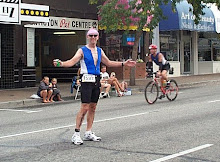
The second phase of my Marathon Mania quest was to run a second marathon within 2 weeks of the first. I finished it today.
My whole schedule was based on marathon availability, but this was a great choice for #2. The race organization runs 4 races simultaneously: 5K, 10K, half marathon, and marathon. Plus there were some walkers. We shared the first half of our course with the half marathon runners. I gotta tell ya, it was hard to keep on going when they peeled off to finish.
I was a bit concerned about the temperature because it was projected to be as warm as 80° today. That's pretty hot for a Washington west-sider what with our recent highs in the 60s. I just planned to hydrate well during the run.
My motel was about a 12 minute walk from the race finish line. The start line was 13 miles away in the hills to the east of Boise. Since we were bussed to the start from the finish area I picked a motel that would allow me to walk to the start and walk back at the end. And it was a great choice! Nice room, small kitchen, walking distance to food.
I woke up at about 4:45 and it was pitch black outside. Funny how your placement in a time zone affects daylight. Boise is on Mountain time, but must be WAY west in the time zone. By 5:15 it was starting to get light out and by the time I headed over to my bus it was full daylight. Yesterday I picked up my race packet at the finish line area so I knew the route and the time it would take.
The toilets at the finish had no line so I took advantage of that. You just never know how long you're going to have to wait at the start area.
On the bus ride out I had a great conversation with a young man, 'PJ', who was running the half marathon, his second in less than 2 months and his second ever. He's hooked on endorphins!
Driving in to the start area it was clear that we were going to have a chilly start. All the trees were shaking in the wind. The bus dropped us off right at the base of a big earthen dam on the Boise River. Quite a start location. And it was COLD as we stepped off the bus. I felt sorry for PJ as he was wearing only his race togs. I was wearing a lot more clothing to keep my old bones warm. People were huddled in groups in the lee of any shelter: vehicles, buildings, trees. I got right in with them.
Far too soon I had to leave my shelter to go stand in the wind in the toilet line. Thinking I'd be clever I picked a line most downwind hoping to have wind shelter from the other bodies. Fat chance. The wind just whipped through. And my line hardly moved. Somebody must have been hiding out in the can or something. I finally got my chance and was back out into the wind far too soon.
Back to my original shelter and it had cleared out some. At first I was standing with the crowd outside this shed but when I returned room had opened up inside. In I went. The wind died away and it was warm and toasty inside. We even got to sing 'Happy Birthday' to Laurie who was celebrating her birthday by running the half marathon.
I kept checking my watch, not wanting to go out into the wind too soon. But the time drew near. So I stripped out of my warmups, packed everything up, handed my stuff over to the transport crew, and got into the runners pack. Folks were still picking up their race packets so we ended up starting off about 7 minutes late.
The first mile or so was on a road then we were on to a bike/running path that followed the river. Most of our run was on path from this point. There was a section of 1 or 2 miles in the first half where we were on streets and about a 1/2 mile at our turnaround. Otherwise it was all path.
At the 1/2 marathon end point most of the runners peeled off to the finish and I was left in the lonely crowd heading out on the marathon. Our route was spectacular as we wound along the river and past some pretty snazzy houses.
The miles started to drag as the pain in my legs started to build up and the soreness in my hip increased. Funny how one does mental math: figure out the miles left to the turnaround, can I bear twice as much soreness? At the turnaround we popped off the trail and made a little loop through a residential area. By this time I was taking a gel every couple of aid stations trying to stave off exhaustion.
At about mile 20 I had a fun duel with some young buck. As I gradually came up on him he picked up his pace slightly as I moved out to pass. Of course I took the challenge and picked it up just a little more. Within 2 minutes he was back, sliding past me. "Well," I thought to myself, "two can play at this game." So with 5 miles to go I took it up another notch and just held it. I could hear his footsteps behind me, slowly fading out of earshot. Then we came to a bridge with a slight rise to the crossing. I kept up the same pace and he was toast: no more footsteps.
Then I began to notice the mile markers on the path. Every tenth of a mile there was a marker counting down and the countdown was pretty close to the mileage to finish. Oh, cruel world! Every tenth of a mile. Interspersed with chalked mile markers for our race.

With 3 miles to go I was feeling strong but very sore. Mile 26 was just before we turned off the path into Anne Morrison Park to the finish. There was a very large crowd to welcome us home. I really warmed up to the cheering and encouragement and finished strong.
The heat had really sneaked up on me at the end. I sat down in the shade and it was very clear that I'd been working very hard as my body cooled down. Then on to potatoes (after all, this is the Great Potato Marathon!). I limped over to check the marathon results and the posted results weren't up to my finish time yet. So, back to the shade with a chocolate milk to sip, occasionally glancing over at the board to see if another page of results was up.
When I saw the big crowd gathered I figured they were up so off I went, hobbling over. I scanned down the list for my time and there I was: age group first! Oh man, what a finish to a great journey. Two marathons, two weeks, two wins. Both on gorgeous courses.
Marathon maniacs, I hope you will take me.
Friday, May 7, 2010
Cross in the Spring
The sun was out and it felt like short pants day for bike riding. So instead of riding around the south end of Lake Washington I decided to ride my cross bike on the Seattle City Light Powerline right of way. I hadn't been here since last fall when I tried out my 1-speed, home made cross bike.
It was every bit as hard as I remembered.
There's a couple miles of streets to Cheasty Blvd where you can ride a gravelled path all the way up the hill instead of riding the street. It's in great shape with only a couple of street crossings and a handful of weeps so the trail isn't very wet.
Once you get to the top of Beacon Hill there's a 4 or 5 block ride to get on the grass and away you go. There's always a break by using the Chief Sealth Trail. You can see from some of the pictures that it's a continuous set of swales following the power line. So I could pick a line and make it as hard or easy as I wanted.
And the surface was SOOOO hard to ride on. It's this incredibly lumpy grass, like an old pasture, covered with grass. In many places it was mowed to about 4-5 inches in height. Where it wasn't mowed the grass was about 2 feet tall; I avoided those sections.
There were boggy places and hidden holes and ditches at the base of the swales.
I bounced and pedaled and tried to keep my front wheel down on the really steep hills and tried to avoid the boggiest places. My tongue was hanging out and I was working very hard. From time to time there was a street crossing just for interest.
And it was fun! And it was a workout.
Combined with my first lake swim of the season this morning it was a glorious NW spring day.
Brrrr - Early May Lake Swim
It was great to get into Lake Washington early this year. The last couple of years it's been almost June by the time I hit the open water.
My pool was closed today due to Seattle Parks employee furlow, the sun was out, the wind was light - what more could I ask for the first day to dip?
This morning I dug into the closet and pulled out my long sleeve wetsuit, grubbed through a drawer of gloves, hats, etc. to find my neoprene swim cap and I was good to go.
I chose to go to Andrews Bay because it's frequently a teensy bit warmer this time of year and it tends to be sheltered from the prevailing southwesterly winds. Today the wind was coming from the north so there was a slight chop. Not enough to be bothersome, but not smooth water either.
The parking lot was filled with cars when I got there. The loop around the park is a popular walk so I figured these were walkers. In the lee side of the bath house the sun was shining down and warming everything. My bare feet felt warmed by the asphalt of the parking lot. The struggle to stretch the rubber over my body was like an old friend.
Double check to make sure I had my extra car key around my neck before slamming the trunk door shut.
Then off to the water, pulling on my two caps: neoprene first with a brightly covered latex cap over the top. Stepping out from behind the bath house it was clear that the wind blowing up the chop wasn't a balmy summer breeze, but had a late spring bite.
That first step into the water was a BIG one. The last step off the stairway is into water about knee deep. My feet instantly felt the cold. It brought back all those memories of early season swims. But numbness did not immediately set in and the discomfort did not quickly move toward pain.
I waded out and leaned forward into the water to get horizontal. My hands were chilled immediately but I wasn't left gasping when my face went into the water. With that, I settled into an easy free style across the bay to a prominent point. My hands and feet quickly adjusted to the temperature and the only problem I had was leaky goggles.
At the point I turned around and headed back, feeling a bit dizzy from the cold water. This got me to wondering what the water temperature was. The best approximation I could get was from the King County Lake Buoy. Their measurements indicate that the water is probably in the low 50's F (10-11°C).
It's done. Now I can truly feel like another tri-training season is underway and I get to escape the chlorinated monotony of the pool for the pleasure of open water.
Saturday, May 1, 2010
The Sunflower Relay
I did it! None of my trepidations came to pass and I completed The Sunflower Relay (iron division) today. This was a new version of the course, extending it to a marathon distance.
My previous 2 runnings of the race gave me some inklings about the course, but I had no idea how the added distance would work out.
This race is run as a relay with teams and iron persons. Most of the racers seem to be iron runners. According to the race website about 170 people signed up to run solo and there were about 75 teams. The race founder's vision was to have a low key race in a beautiful setting and they're continuing to pull it off. The historical teams are the most interesting as the team is required to have a young runner (14 or younger), an older runner (40 or older), and at least 1 female member.
Driving into the valley yesterday I immediately noticed the stiff, cold wind, especially when I got outside my car. At our race briefing this morning, the race director told us that it had rained (and snowed) earlier in the week. However, today started out with blue skies and puffy white clouds.
By the time we got out of the buses at the race start (this is a point-to-point race) the wind had picked up and was blowing something like yesterday. That was to be the theme for the day. There was even a very light sprinkling of rain just before the start. We could look back up the valley toward Washington Pass and see some kind of precipitation coming down.
At the race start I got to see and talk to friends and acquaintances. Earl was here and we rode up to the start on the bus together. After we got out there was Andy and Andrew and Nick and a bunch of Andrew and Nick's friends, all young. There was the usual stripping and hanging out for a few minutes in the raw air before the start and then we were off with a very casual countdown.
The first mile or so was on the paved road then we ducked onto the ski/bike trails. On this leg we got to cross a suspension bridge over the Methow River and boy was that weird! All the heavy footfalls caused waves on the bridge deck that were very weird to run with. The bridge swayed from side-to-side and the waves ran the length of it. More than once I stepped onto the top of a bridge deck wave. Kinda like running on an uneven surface and striking a rock.
This section took us to the 5 mile point and the old starting point and now the first relay exchange point. Then a couple miles on dirt road followed by a lot of twisty-turny stuff on single track and poor quality dirt road. The woods were very open and it was most pleasant to get off the main road as cars were driving along it and kicking up dust.
After aid station #2 we settled in for a long, gradual downhill on good quality dirt road to the river. Then great single and double track through the woods and cattle gates to Wolf Creek Road. This was paved and we ran a couple miles on it to aid station #3 where we left the road again to get back on the trail system.
This took us to the edge of the valley and the half way point - a sign stuck into the ground reading "13.1 miles get ready for up up up". And up it is - just over a mile of steady to steep uphill on a gravel/dirt road eventually leveling out and crossing the highway by Patterson Lake and just downhill from Sun Mountain Lodge.
A couple switchbacks brought us up to the trail along Patterson Lake. This is probably my favorite section of the run. We started out in forest with the lake to our left with the trail undulating and traversing the side of the hill. After a time the forest opens up to give even greater vistas and flowers. Just past the end of the lake is aid station #4.
This next section is nicer than the last time I was here when there had been logging activity. Now the logging scars have kind of healed over and we ran through very open, high altitude pine forest on nice single track. There was a short section on the road then back into the woods for a long downhill finish to aid station #5.
It was in this section that we passed the 17-mile mark and I was amazed at how good my legs felt. At that point I knew that I was going to finish well.
Right out of this aid station we went up a steepish hill maybe a 1/2 mile long - very challenging. After topping this hill we were treated to grand vistas of rolling grassland. Our route followed a descending, rocky road eventually coming out on a better quality dirt road and a high traverse above a lake. This was a long, long downhill and just past the end of the lake was aid station #6.
I had my second GU and refilled my water bottle for the last time. More up, down, up, down to pass the last little lake on the run. The dreaded final downhill was getting closer and closer as the miles ticked by. We crossed a pasture then switch-backed up this old, old 2-lane track to the last aid station, near the top of the run. At this aid station I ate a final GU and downed an electrolyte cap with a couple cups of water.
A bit more descent through a Ponderosa Pine grove and the final drop was visible. I had forgotten how we traversed way around the top of the valley. Today this traverse was into a blustery headwind. Somewhere in this section we had to go through a barbed wire fence. The race folks were kind enough to tie it up for us so I only had to bend over and slip under. Finally there was the technical downhill to the valley where we had a half mile or so of gently descending rocky road in a picturesque little valley.
This opened up to great, open grassy areas with horse tracks where I was really able to pick up my speed. I'd been hoping for a 4:15 finish but at mile 25 I was at 4:08 so it just wasn't gonna be.
The finally 200 meters or so were very welcome. This was a change from previous years as we left the road and ran across a pasture. I was very nervous about the footing as it was pretty uneven. That finish line was very welcome.
My legs held up well and don't feel too dead right now. A bit of ice, on to the awards/swag ceremony then some sleep.
Bring on Boise. I feel like it should be manageable.
Friday, April 30, 2010
Pre-race jitters
Well, it's here. I've been thinking about this for months now and the time has just whipped by. When I made the decision in January to take a run at becoming an official 'Marathon Maniac' it seemed very far away.
Through nothing but chance the Sunflower Relay was changed to a marathon distance this year. It's a race that I love to do so I checked on the web and found the Boise Marathon 2 weeks later!
With that I was off and running.
Now the training is over and I'm supposed to be rested, but, of course, I'm plagued with all kinds of pre-race jitters.
Right now I've got my old guy aches and doubts. What have I got myself into? On the drive over all I could think about was how tired my legs will be at the finish tomorrow. Is that itchiness in the back of my throat a cold coming on? Will I step in a hole or slip on a rock and wrench my back?
O, woe is me!
Let's see how tomorrow goes.
Monday, March 22, 2010
A run at Coal Creek

On the last Sunday of winter I wanted to run the Coal Creek Trail. This trail has a very interesting history: at the turn of the 20th century it was an active coal mining area. Photos posted on an information kiosk show an area that was totally industrialized.
Today the forest has reclaimed most of the land and there are only occasional clues to the past to be seen.
My interest was not historical but was spiritual. The lower section of the trail is almost magical with moss and ferns growing from the trees and the sounds and sight of the creek add to the magical effect. I've been on this trail in the winter after a cold, foggy night and the moss-covered trees have an additional coating of frozen fog.
Spectacular!
This was a much warmer day and I wanted to enjoy the sense of spring in the air.
In addition, I was returning to this trail for the first time since it had been reopened following flood damage repairs.
What a job the Bellevue Parks department has done. The lower section of the trail, where I started has been regravelled and the bridge that washed out has been replaced by a very sturdy structure.
The middle section of the trail is pretty much unchanged. However, the Primrose section of the trail is officially closed. This means that if you want to visit Primrose Falls you'll have to make an unofficial side trip. And there's a new side trail further along that heads off toward Lakemont. I didn't check it out but I assume that it goes to a new trailhead access point.
Much of the upper trail has been widened and barked. This really deals with all the mud that used to be here. I can never get enough of the 2 waterfalls that are just next to the trail in this section. Plus, the information kiosk is located here so that you can read about the history of Coal Creek and see the industrial pictures.
I wanted a teensy bit more mileage than the loop so I crossed the road to the Redtown access point to Cougar Mountain Park and ran a short loop before returning to my car.
This trail is just magical. I can never seem to get enough of it. The fresh forest, the creek, the use of industrial materials in the trail, the mud, the roots: it's all there.
Monday, March 15, 2010
Our January trip to Hawaii...
The weather
Clearly the reason to go to the paradise of Hawaii is the weather. It’s balmy all the time, especially for a northwesterner, with temperatures mostly in the 70s. Never much higher, never much lower. This January we went to Kuaui, the ‘Garden Island’, so named because the central mountain, Mt. Waialeale, gets more than 400 inches of annual rainfall!
Our first week was sunny and warm; the second week brought some rain. We only had heavy rainfall at night, but even the daytime rain that we encountered was warm. However, the rainy period did leave the mountain cloud-shrouded and left us looking for hikes at lower altitude.
More on this later.
The food
One of the high points for us was the food. I, especially, was looking forward to lots of tropical fruits but it turns out that January is an off season so the fruit selection is pretty lame. We just had to make do with papayas, pineapples, and bananas. One of our days we went to a farmers market and bought an UNBELIEVABLY good pineapple – the best we’d ever had.
My friend Gary told us about the Koloa Fish Market and was that ever great advice. The grilled fish was terrific, but we were introduced to poke and just fell in love. Poke is raw fish mixed up with other ingredients: maybe seaweed and sweet onion or Korean flavored. Eaten with rice and some fresh vegetables it’s a meal to die for. You can get it at just about any grocery store, even at Safeway.
Gary also told us about ‘Savage Shrimp’ a roadside vendor of grilled shrimps. This was a van, kind of like a taco wagon, whose sole fare was grilled shrimp served with rice. Turns out this was just around the corner from us so we were able to go out our back door, walk across the street, and order up. The vendor was also kind enough to sell us a 1-1/2 order, just enough for the two of us.
We also found Papaya's natural/organic food store in Kapaa so we could buy organic. On one of our trips a woman just started talking to us in the bulk foods area. She told us about lilikoi chiffon pie at the Hamura Saimin restaurant. We had to check this out and ended up buying a whole pie. It took us several days to eat and every bite was good.
Hiking
 Kauai has lots of hiking, from shorelines and beaches to lowland mountains to high mountain ridges. With the moderate weather of our first week on the island we were able to get up high without getting wet. Mt. Waialeale sits on the island like the hub of a wheel and numerous ridges radiate out to the coast. Many of these ridge tops have trails or roads. We chose to hike the Nu'alolo Trail. It went almost straight west and ended on an escarpment 2000 feet above the ocean. We could look down into the lush Nu'alolo Valley and see the surf pounding the Napali coast.
The downside of these ridge hikes is that you have to walk uphill to return. Our return gave back the 1500’ of elevation that we’d lost hiking out.
This trail showed the effects of heavy rainfall but even more dramatic was the Powerline Trail. As one of our guidebooks pointed out, this trail is clear evidence of why you see hunter’s pickup trucks with 4-foot lift kits. In some places the tire ruts were 3-1/2 feet deep!
On a couple of our hikes we were lucky to be able to eat ripe guavas right off the tree. We later found out that the guavas are non-native and are spread by the feral pigs.
 Bookending our whole trip was a walk south from the resort strip to Maha'ulepu Beach (a real gem!). I ran part of this shore-side trail on our first day and Janet walked it on the second. It has long, sweeping beaches, dramatic surf, sedimentary (sandstone and limestone) and volcanic cliffs, sighing/breathing rocks, even a sacred Hawaiian heiau. We closed out our trip by taking our last walk in this place, as well. Got a little of that warm, tropical rain and all the drama of this shoreline.
Running
Before leaving home I had checked MapMyRun to see if there were any runs logged for Poipu on Kauai and found only one. My big need was to be able to get in a single long run in final preparation for the Death Valley Marathon. This scarcity of MapMyRun runs left me to my own resources to figure out a route.
My first run was exploratory, heading north from our condo toward the big Poipu hotels. This is when I found the Makawehi cliffs and trail. A great find because I kept coming back to it and liking it more and more. With each excursion it revealed a little more of itself. On my first exploration I was blown away by Shipwreck Beach and the incredible meadows just before …. On later trips I saw the diving board cliffs and the porous cliffs that breathed with the surf.
Gift shopping
The folks in Janet’s office have a tradition of bringing back “gifts” to each other when a team member goes on vacation. Generally these gifts are something that you keep at your desk out of respect to the giver but they’re not something you’d typically get for yourself. She decided to try something different so we went to the Salvation Army and went through their rack of Hawaiian shirts and she got one for everyone.
They loved ‘em and even scheduled a Hawaiian lunch shortly after receiving them.
Sites
Oh, the places to see.
The mountain: Mt. Waialeale, big, rugged, green, rainy, muddy.
The beaches: some with surfers, some with fish, one with glass, one with engine blocks.
The plants: one of a handful of sites with tropical botanical gardens, well worth an afternoon
The weather
Clearly the reason to go to the paradise of Hawaii is the weather. It’s balmy all the time, especially for a northwesterner, with temperatures mostly in the 70s. Never much higher, never much lower. This January we went to Kuaui, the ‘Garden Island’, so named because the central mountain, Mt. Waialeale, gets more than 400 inches of annual rainfall!
Our first week was sunny and warm; the second week brought some rain. We only had heavy rainfall at night, but even the daytime rain that we encountered was warm. However, the rainy period did leave the mountain cloud-shrouded and left us looking for hikes at lower altitude.
The food
One of the high points for us was the food. I, especially, was looking forward to lots of tropical fruits but it turns out that January is an off season so the fruit selection is pretty lame. We just had to make do with papayas, pineapples, and bananas. One of our days we went to a farmers market and bought an UNBELIEVABLY good pineapple – the best we’d ever had.
My friend Gary told us about the Koloa Fish Market and was that ever great advice. The grilled fish was terrific, but we were introduced to poke and just fell in love. Poke is raw fish mixed up with other ingredients: maybe seaweed and sweet onion or Korean flavored. Eaten with rice and some fresh vegetables it’s a meal to die for. You can get it at just about any grocery store, even at Safeway.
Gary also told us about ‘Savage Shrimp’ a roadside vendor of grilled shrimps. This was a van, kind of like a taco wagon, whose sole fare was grilled shrimp served with rice. Turns out this was just around the corner from us so we were able to go out our back door, walk across the street, and order up. The vendor was also kind enough to sell us a 1-1/2 order, just enough for the two of us.
We also found Papaya's natural/organic food store in Kapaa so we could buy organic. On one of our trips a woman just started talking to us in the bulk foods area. She told us about lilikoi chiffon pie at the Hamura Saimin restaurant. We had to check this out and ended up buying a whole pie. It took us several days to eat and every bite was good.
Hiking
 Kauai has lots of hiking, from shorelines and beaches to lowland mountains to high mountain ridges. With the moderate weather of our first week on the island we were able to get up high without getting wet. Mt. Waialeale sits on the island like the hub of a wheel and numerous ridges radiate out to the coast. Many of these ridge tops have trails or roads. We chose to hike the Nu'alolo Trail. It went almost straight west and ended on an escarpment 2000 feet above the ocean. We could look down into the lush Nu'alolo Valley and see the surf pounding the Napali coast.
The downside of these ridge hikes is that you have to walk uphill to return. Our return gave back the 1500’ of elevation that we’d lost hiking out.
This trail showed the effects of heavy rainfall but even more dramatic was the Powerline Trail. As one of our guidebooks pointed out, this trail is clear evidence of why you see hunter’s pickup trucks with 4-foot lift kits. In some places the tire ruts were 3-1/2 feet deep!
On a couple of our hikes we were lucky to be able to eat ripe guavas right off the tree. We later found out that the guavas are non-native and are spread by the feral pigs.
 Bookending our whole trip was a walk south from the resort strip to Maha'ulepu Beach (a real gem!). I ran part of this shore-side trail on our first day and Janet walked it on the second. It has long, sweeping beaches, dramatic surf, sedimentary (sandstone and limestone) and volcanic cliffs, sighing/breathing rocks, even a sacred Hawaiian heiau. We closed out our trip by taking our last walk in this place, as well. Got a little of that warm, tropical rain and all the drama of this shoreline.
Running
Before leaving home I had checked MapMyRun to see if there were any runs logged for Poipu on Kauai and found only one. My big need was to be able to get in a single long run in final preparation for the Death Valley Marathon. This scarcity of MapMyRun runs left me to my own resources to figure out a route.
My first run was exploratory, heading north from our condo toward the big Poipu hotels. This is when I found the Makawehi cliffs and trail. A great find because I kept coming back to it and liking it more and more. With each excursion it revealed a little more of itself. On my first exploration I was blown away by Shipwreck Beach and the incredible meadows just before …. On later trips I saw the diving board cliffs and the porous cliffs that breathed with the surf.
Gift shopping
The folks in Janet’s office have a tradition of bringing back “gifts” to each other when a team member goes on vacation. Generally these gifts are something that you keep at your desk out of respect to the giver but they’re not something you’d typically get for yourself. She decided to try something different so we went to the Salvation Army and went through their rack of Hawaiian shirts and she got one for everyone.
They loved ‘em and even scheduled a Hawaiian lunch shortly after receiving them.
Sites
Oh, the places to see.
The mountain: Mt. Waialeale, big, rugged, green, rainy, muddy.
The beaches: some with surfers, some with fish, one with glass, one with engine blocks.
The plants: one of a handful of sites with tropical botanical gardens, well worth an afternoon
Monday, January 11, 2010
Why do Ironman?
The question how did you decide to race at Ironman was posted on the TRI-DRS list serve. Following is my response.
I started triathlons in 1986 by watching a friend compete in one the previous year. I'd known him for a number of years through climbing and he was about as far from appearing to be your typical slow twitch athlete as you could imagine. But it looked like FUN.
That started a winter of swimming followed by starting to compete the next year.
Within 2 years I'd become involved in a local tri club and had watched videos of Ironman Canada. I was just amazed that humans could do what I was seeing. And that video moment of Tom Price reaching out to the fallen race leader just after the run turnaround at OK Falls was such a pure demonstration of sportsmanship that you just had to love it. I got to hear the voice of Steve King on video before I heard it live. And those early years colorful folks: Z-man, Cowman, "The Moose", that guy with all the kids who wore blue jean cutoffs and ran barefoot. How could I not be intrigued?
My first time racing at IMC (1988) I has still a tri newbie and definitely didn't know much about the ironman distance.
But it was a mystical experience. I get chills right now, just picturing myself back out on that run course, heading back to Penticton. It was painful but being able to manage that pain and move ahead made me feel powerful and capable. Finishing was an absolute high - and not because someone shouted out "You're and Ironman!". I felt like I'd really accomplished something.
Over the next few years I build up a cadre of training partners who have become friends. This has been a part of the ongoing experience that keeps me coming back.
In 1997 I had an epiphany experience. It was a race when everything went well. The conditions were perfect, I was fit, and the race felt effortless. I just glided along. It was like the most incredible drug experience you could ever imagine. That set a new benchmark, one that I keep trying to get back to.
Now, in my more mature ironman experiences I have sufficient experience to anticipate the high, dread the pain, and manage it all. I've been lucky enough in life to be able to continue following this dream and to find it very fulfilling.
So, for me, deciding to start was just the first baby step on a journey that's led me to places in never imagined would be there for me. I think that may be what that first decision is all about. It's a truly life-changing decision and has the possibility to take you where you might never go.
Wednesday, January 6, 2010
Stuck on Tiger Mountain


With the new year off to a running start at the Resolution Run 5 mile, my next goal was to run (walk?) in the Fat Ass 25K (7000+ ft of elevation). This is a very informal trail run on Tiger Mt., 15 miles or so east of Seattle.
Basically, you show up, sign the book indicating the distance you intend to run, and start running at 8:00 a.m. No money, no fuss. I'd talked it up after the Resolution Run and I was very pleasantly surprised to see Patty and Trevor at the start. We chatted until the official start time then we were off.
Trevor and his dog shot up to the front never to be seen again that day. Turns out he finished the 25K in 2:25.
Tiger Mt. is a maze of trails. I'm always fearful of getting lost when I go there because not all trails are signed on the ground nor marked on maps. The race organizer keeps the getting lost factor down by pre-running the course and hanging Christmasy ornaments and things at each turn. By being alert one won't get lost.
The run starts out with a gentle drop towards the west (Issaquah), passes behind Issaquah High School, then climbs for a couple of miles. It's a very gentle rise trending generally south and east. Ultimately we reached the summit of West Tiger #1, then Tiger #2, and finally Tiger #1 where we made our final descent.
Here's a cue sheet for those interested:
| Miles | Cum mi | Direction |
| 0 | 0 | High Pt. Lower Parking Lot |
| 0.5 | 0.5 | Swamp Trail (Shortened) Right at Power Line off Upper Park Lot |
| 0.6 | 1.1 | Bonneville Power Line (Double Power Line) - jog to right |
| 0.1 | 1.2 | Brink Trail (Left) |
| 0.4 | 1.6 | Right at Power Line to Overlook |
| 0.7 | 2.3 | Issaquah High School Trail (Detour around Construction) |
| 0.7 | 3 | Poo Poo Pt. Trail |
| 0.2 | 3.2 | Cross Power Line |
| 2.8 | 6 | One View Trail (continue up) |
| 1 | 7 | Right on Tiger Mt. Trail (TMT) |
| 0.9 | 7.9 | Dieter Spring |
| 0.9 | 8.8 | 15 Mile RR Grade |
| 0.3 | 9.1 | Paw Print Rest Station |
| 0.7 | 9.8 | Continue on 15 Mile RR Grade |
| 0.9 | 10.7 | Left and up Bootleg |
| 0.4 | 11.1 | Right on NIER bypass Trail (West Tiger #1) |
| 0.3 | 11.4 | Down Tiger Mt. Road, Climb over Gate |
| 0.5 | 11.9 | Up to Tiger #2 |
| 0.5 | 12.4 | Down and Up Saddle to Tiger #3 |
| 2.7 | 15.1 | Down West Tiger (Tradition Lk) Trail past Up Park Rest Room |
| 0.5 | 15.6 | High Pt. Lower Parking Lot |
| 15.6 | Repeat! | |
The day was pretty warm at the start so I had to remove my jacket a mile or so into the run. I packed it away in my fanny/hydration pack and hooked up with Patty as she was coming by. We ended up running/yakking together for the entire run.
At West Tiger #1 we came out of the forest and the wind was just howling across the ridge top. It was so cold that we dropped back into the forest and put our jackets on. I didn't know it at the time but when I pulled my jacket out of my fanny pack I also pulled out my car key.
This was clearly a BIG problem when I got back to the car and couldn't get in! Was I pissed.
Patty was kind enough to give me a ride to my house so that I could at least get home.
At that point I was faced with a decision about leaving my car at the trail head overnight or trying to get back to it that day. I'm the only driver in our house and that's also the only car that we have. After eating and clearing my head with helpful insight from Janet we figured out that I could load my bike onto a bus, ride the bus to Issaquah, and then pedal on from there to retrieve the car.
This is exactly what I did and it worked out just fine.
Now there's a key lying somewhere along the trail at West Tiger #1 waiting to be retrieved.
The race organizer took some cool photos on the run. Many thanks to Ron Nicholl for graciously allowing me to post them here.
Friday, January 1, 2010
2010, Off on the Right Foot
One could also say off on both feet, but that sounds kinda weird.
For the past several years I've started the year with the Fort Steilacoom Running Club's "Resolution Run" series. Aptly named because the first race is on New Year's Day then 3 more races at 1-month intervals. Details here.
Today's race was the 5er (KM or miles) and I ran the miles. It's always fun to see my endorphin junky friends at this race so I was quite looking forward to it. This year, however, I've also scheduled myself to run in the Death Valley Marathon in February, so that looms pretty big right now. Funny sort of perspective for a 5 mile race.
Then the big surprise.
Janet calls out to me as I'm starting my morning routine would I like it if she goes with me. "Sure," says me. Then she says, "What if I were to run the 5K?".
Well, Janet hasn't run for some time what with her failing vision and the last time she ran in a race was a giant disaster. She ended up tripping over a curb and falling smack on her face and scraping up much of the front of her body.
I know that she's gutsy, but that's REALLY gutsy. There's a section of gravel where the run course leaves the track and at about the 1 mile mark it's pretty dark from overhanging trees. These kinds of hazards are very difficult for her to negotiate.
My goal was to run the 5 mile race in 36 minutes which would be a real stretch since I've been doing nothing but endurance running for months now.
This race is about the most civilized race that you could ever imagine. The start/finish venue is a high school and all the athletes have full access to the common areas and the locker rooms (with showers!). We both brought shower gear and a full change of clothing so that we could take full advantage of the showers.
I took a couple of warm-up laps around the track (the race starts and ends on the track) and Janet did some yoga poses for her warm-up. We separated for the start - me towards the front of the pack and her towards the back of the pack.
With the usual informal start we were off and running.
By the time we rounded the track and ran up the hill I was into heavy breathing mode. Runners from both races followed the same course out with the 5K athletes turning around at the 2.5K mark and the mile runners continuing on to the 2.5 mile mark.
After a mile or so everyone settled in to their pace and I was running with a group of the same runners. The lead runner in the 5K race went by me on his return 200m or so from his turn-around. And he was at least 100m ahead of the second place runner.
As I passed the kilometer turn-around, the pack really thinned out. Most of the runners were racing in the 5K event. Some little rises over the next mile and we were to the turn-around.
Back to the KM turn-around point and I started looking for Janet. There were still walkers coming out and she said she'd be walking.
No Janet, no Janet.
The 4-mile mark and no Janet.
Across the last big street and back towards the finish and no Janet. I was starting to get a bit worried.
Down the hill and back onto the track and there she was running along, heading for the finish. Cool, running!
I could hear Trevor shouting out my name to pass the runner ahead of me. All this got me was a quick backward glance from that runner and a pace pickup.
As I rounded the last turn in the track and headed down the finishing straight away I could hear the race director calling out the names of athletes. A little closer and I could see the clock: 34:36!
This urged me on to finish strong and I clocked in at under 35 minutes. A great feeling.
I walked a few steps, talked to Trevor, and turned back to the finish as Janet was walking out of the finisher's chute. She was really happy, I was really happy.
The wind had picked up a little and we were both sweated up so we headed in for a warm shower.
Showers were followed by hot food (chile), companions, and awards. Janet and I sat at the champions table. We had 4 AG first place finishers: 5K M35-39 (Trevor), 5Mi F45-49 (Patty), 5Mi M60-64(me), 5Mi M65-69 (Marv) and 2 second place AG finishers: 5K F60-64 (Janet), 5Mi F45-49 (Liz) at our table.
We brought home the software and started 2010 out right.
I'm off to a
Lost in China Camp
It's one of those primal fears that trail runners have, sort of like getting eaten by a mountain lion. That fear is getting lost while on the trails.
I got to experience this twice over the past week.
Janet and I spent the week between Christmas and New Year in California (San Rafael) where she got to spend time with her ailing mother, we both got to work on some tasks related to her mom's move to her current living situation and we both got to visit her ailing Aunt Janet, and I got to get in some trail running.
We were staying in San Rafael (Marin County, California) and there are gobs of open spaces and parks in Marin (Marin County open spaces, China Camp State Park, Mt. Tamalpais State Park, Pt. Reyes, etc. etc. ) suitable for trail running. It's a trail runner's paradise.
During our previous visits I'd spent most of my time exploring the Sleepy Hollow Open Space, near our motel. The last time there I'd made it all the way to the "Metallica Gate" and I was longing to explore a little more. With this in mind, I emailed a trail runner who I'd met at a family gathering a couple years ago to see if I could hook up and to get some guidance on other areas to explore. We didn't get together but I did get to explore.
China Camp was within running distance of our hotel and it rained on Christmas day so I thought that running mostly on paved surfaces would be desirable. The soil in that area is very, very sticky and I didn't want to run with big gobs of mud stuck to my feet. Using a published map I saw that I could run around the point and take some residential streets up to a fire road access point.
Every thing was fine to the residential road access point (Sunny Oaks Dr) and my run up to the fire road. I totally misjudged the distance to the Echo Trail entry point and started into the China Camp area on some unofficial trail. I ran downhill then back up hill and ended up on some very obscure trails and at one point bushwhacked uphill through an open stand of oak trees.
Eventually I got to a more well-traveled trail and ended up circling back around to my trail start point. What a relief! No mountain lion snack and back on familiar ground.
The next day I drove to a starting point and ran a loop up the Bay View and Echo Trails. This clearly showed me my error from the previous day as the trailhead was very well signed. The same fire road took me up higher and I was able to loop back down to my starting point.
Day three had me feeling more cocky and I had more time. This time I started from the same point as for day two but continued further along the fire road. I should have been more concerned as my map didn't seem to match the spare signage that I saw.
However, I was confident (filled with hubris?) and continued onward with what felt right. Never a good or smart thing to do.
When I finally emerged from the forest it was at a trail head at the end of a cul-de-sac in a residential area. My map didn't show any of the street names so I set off in what I thought was the right direction. Eventually I ended up at another cul-de-sac trail head and headed back uphill.
After much more uphill I ended back up on a section of the trail that I'd just descended!
So back down to the residential area again to look for someone at home on a weekday. I turned the other direction at the end of this street and kept my eyes open. By this time I was getting nervous as I was supposed to be picking up Janet and her mom to go to lunch with some friends and I was now late. Within a couple of blocks I saw a man working in his garage and asked for directions to San Pedro Road. I knew that I could follow it back to the car.
When I got to San Pedro Road it was clear that I was a long ways from the car. In fact, more than 4 miles away! I called Janet to let her know I was delayed by getting lost and set out running as fast as I could. Just after crossing the park boundary I saw a trail head. This looked much more inviting than running along the edge of a curving, shoulder-less road.
The trail name was intriguing, Shoreline Trail, and much more pleasant than the road. So off I went and it was a good choice. The trail pretty much paralleled San Pedro Road, except where it dipped way inland to bypass a wetland area. Unlike the other trails I'd been on it was also very smooth and rock- and root-free enabling me to move right along.
The mileage indicators at the Ranger Station were disappointing (4.6 miles to the campground and my car!) and I think were wrong because I covered the distance pretty quickly.
In any case I kept moving and in a reasonable time came out to a point where I could see the car across a big wetland area. Not wanting to make another wetland trail detour I took to the road shoulder for the last half mile or so. Boy was that car a welcome sight.
Once again saved by luck and pluck. With so much more open space to explore, who knows when I'll be back to China Camp. But I'll certainly remember it for a long, long time.
Subscribe to:
Posts (Atom)